Idaho City · Boise National Forest
The best dates go to the first call we get.
Thanks for stopping by. Enjoy the gallery, read our story, and follow the journey on Instagram and Facebook.
The Ponderosa Pine Scenic Byway runs 130.869 miles from Interstate 84 in Boise to the junction of Highway 75 in Stanley — straight through the heart of Idaho's mountain wilderness. It crosses five national forests, climbs four summits, follows two rivers, passes through one gold rush town, and delivers you to the base of the Sawtooth Mountains with the feeling that you have traveled much farther than the odometer says.
This road existed before Idaho was a state. It began as a toll road franchised in January 1864 — $1.50 per two-horse wagon — built to move gold, freight, mail, and miners between Boise and the Boise Basin gold camps at Idaho City. The Ponderosa pines it was named for were already centuries old when the first wagons rolled through. The road is better now. The trees are the same.
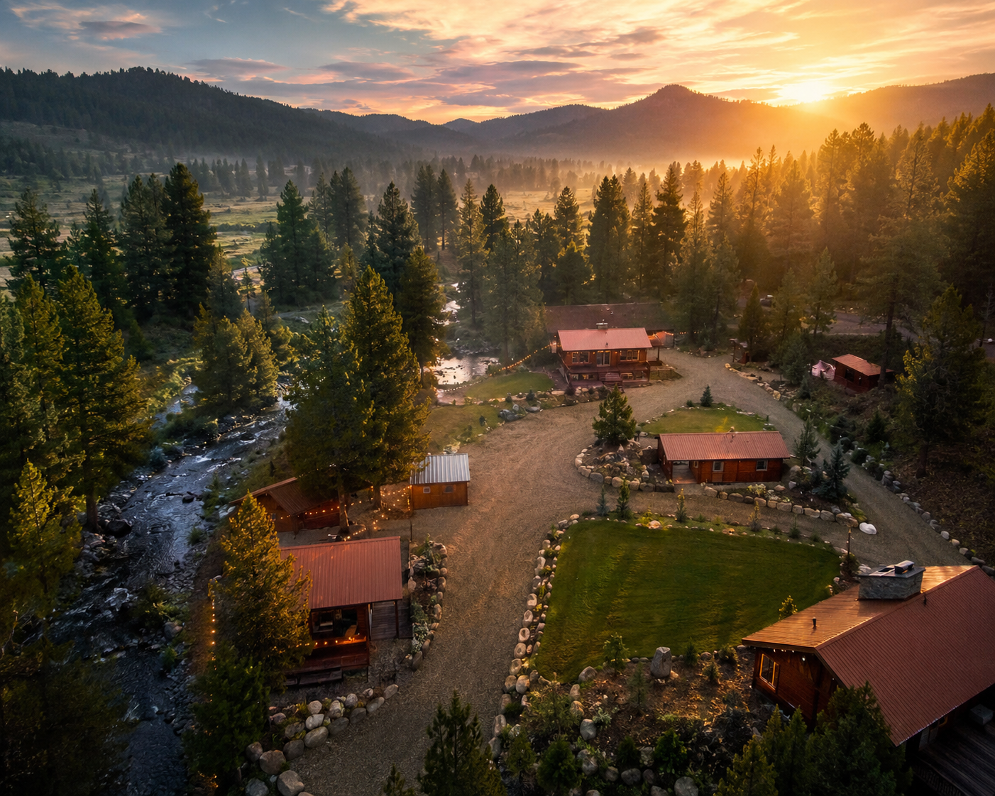
Majestic Mountain Ranch sits at mile 37 — one mile south of historic Idaho City, directly on the byway, with the Boise National Forest starting at the property line. It is the first major stop on the byway out of Boise and the only full-property lodging anchor on the entire 130-mile corridor. Everything north of here is a day trip with a home base waiting when you come back down the mountain.
Follow the byway from the valley floor to the Sawtooth Mountains. Elevation climbs 4,000 feet. The road narrows, the pines grow taller, the towns get smaller, and the sky gets bigger with every mile.
The byway begins at Exit 57 of I-84, southeast of downtown Boise — Idaho's capital and the Treasure Valley's anchor city of nearly 250,000. From here Highway 21 heads northeast, immediately leaving the valley grid behind. Within minutes the sagebrush foothills open up and the Boise River corridor begins.
Visit Idaho — Boise →The first major stop on the byway. Three units: Discovery Park for picnicking and river fishing; Sandy Point for swimming and beach; Spring Shores for boating and marina access. Lucky Peak Dam was built 1950–55 by the Army Corps of Engineers. The reservoir stretches for miles into the Boise Range — spring brings elk and deer herds to the hillsides above the water in numbers that stop cars on the highway.
Idaho State Parks — Lucky Peak →A short detour east off HWY 21 at the Mores Creek Bridge. When Arrowrock Dam was completed in 1915, it was the tallest dam in the world at 350 feet. The reservoir it forms is quieter than Lucky Peak — free camping, vault toilets, good kokanee and trout fishing. The drive in is narrow dirt road and the payoff is real solitude within 15 miles of Boise.
Bureau of Reclamation — Arrowrock →The transition point. Sagebrush steppe gives way to dense Ponderosa pine forest right around mile 18 as the byway enters the Boise National Forest. The shift is dramatic — open foothills to cathedral pines in less than a mile. From here north, the trees own the road.
USDA — Boise National Forest →The only full-property lodging anchor on the entire 130-mile byway. Six acres of gathering ranch inside the Boise National Forest — one mile south of historic Idaho City, directly on Highway 21. Hot tub, fire pits, creek-side decks, seven spaces, and Shelly Robertson's personal hospitality. The Springs hot springs is five minutes away. Four hundred thousand acres of trails start at the property line. Everything north is a day trip. This is where you sleep.
Thirteen miles northeast of Idaho City, the road crests the divide between the Boise River and Payette River drainages. This is the point where you leave the Boise Basin behind and begin the descent into the South Fork Payette River country. Park-N-Ski area here provides winter backcountry access, with yurts available for overnight stays through Idaho State Parks.
Wikipedia — Mores Creek Summit →The road narrows and the speed drops to 35 mph as the byway begins its dramatic switchback descent toward Lowman — 2,240 feet of elevation lost in tight turns above the canyon. Slow is not a suggestion here. The views through the turns are some of the most dramatic on the entire byway. Take your time. The vastness of the Boise National Forest below earns every second.
Visit SW Idaho — Byway Guide →Population 42. Geothermal area — natural hot springs in and around the community. This is the junction with the Wildlife Canyon Scenic Byway (Banks-Lowman Road), which follows the South Fork Payette River downstream to Banks. In 1989, the Lowman Fire burned 72 square miles and 26 structures in the drainage — seven pullout interpretive stops along the road chronicle the fire and the forest's recovery. Trudy's Kitchen is here: huckleberry cheesecake, mountain meals, a reason to stop.
Visit SW Idaho — Lowman →One of the most celebrated natural hot springs in Idaho. Geothermal water pours off the cliff at 110°F into rock-walled pools of varying temperature directly on the bank of the South Fork Payette River. The hot waterfall is the centerpiece — soak under it, then cool off in the snowmelt river running alongside. Day use only, 7am–9pm, $5 per vehicle. Pine Flats and Bonneville Hot Springs are within 20 minutes for those who want solitude over spectacle.
USDA Forest Service — Kirkham →The turnoff to Grandjean provides one of the primary access points into the Sawtooth Wilderness — 217,000 acres of ponderosa pine, granite peaks, and steelhead streams. Beyond Grandjean, the byway begins its final climb toward Banner Summit through nearly 70 documented avalanche paths. The closure gate sits here in winter. This is the last easy turnaround before the road becomes a serious commitment.
USDA — Sawtooth Wilderness →The apex. At 7,037 feet on the Boise–Custer county line, the byway crosses from the Boise National Forest into the Challis National Forest — and from the Payette River drainage into the Salmon River drainage. The road from here drops into Bear Valley and the upper Salmon River watershed. From the summit on a clear day, the Sawtooth Range fills the southeastern horizon. Nearly 70 avalanche paths in the 11-mile stretch below make this section the most frequently winter-closed on the byway.
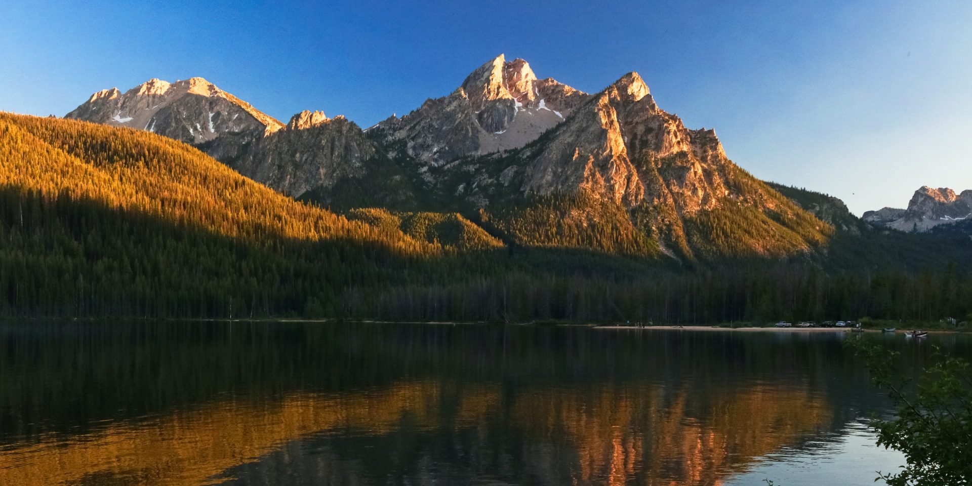
Wikipedia — Banner Summit →Seven miles west of Stanley on HWY 21, Stanley Lake sits in the northwest corner of the Sawtooth NRA. The overlook here frames McGown Peak reflected in the water — one of the most photographed views in Idaho. Three campgrounds with reservation sites, boat ramp access, fishing for rainbow, bull, cutthroat, and brook trout. Hiking trails reach Lady Face Falls and Bridal Veil Falls from the trailheads here.
USDA — Stanley Lake →Population ~63. At the junction of Highways 21 and 75, Stanley sits at the base of the Sawtooth Mountains surrounded by the White Cloud and Boulder ranges. The Sawtooth NRA offers 700+ miles of trails. Redfish Lake — the largest lake in the Sawtooth National Forest, 15 minutes south on HWY 75 — is the destination most people are aiming for. The byway connects here to the Sawtooth Scenic Byway east and the Salmon River Scenic Byway north. Also: hot springs at the Mountain Village Resort. Also: the Central Idaho Dark Sky Reserve, the first Gold Tier dark sky reserve in the United States. Stanley is not a place you pass through. It is a place you arrive at.
Stanley Chamber of Commerce →The South Fork Payette River runs high and fast with snowmelt — whitewater rafting season peaks. Wildflowers in the lower elevations by May. Higher sections may still have snow closure through late April. Elk and deer herds visible on hillsides above Lucky Peak and Arrowrock. Check Idaho 511 before driving north of Idaho City.
Full byway open. Hot springs crowded but spectacular. Redfish Lake and Stanley are at their most alive — kayaking, hiking, live music at the lodge. Temperatures at 7,000 feet run 20–30°F cooler than Boise valley. The corridor between Lowman and Stanley is peak hiking and backpacking season. ATV season in the Idaho City Ranger District is fully open.
The best kept secret on the byway. Labor Day to Halloween, the mountains between Idaho City and Stanley turn: golden quaking aspen, scarlet rosehips, orange mountain-ash, reddish Rocky Mountain maple. Color peaks early to mid-October depending on elevation. USDA Forest Service calls it the first excursion Idaho locals recommend to newcomers. Large ponderosa pines smell faintly of vanilla in the October air. Fewer people. Cooler temperatures. The road at its most beautiful.
USDA — Fall Color Guide →The section between Idaho City and Lowman — and especially Grandjean to Banner Summit — frequently closes due to avalanche danger. Nearly 70 avalanche paths in that 11-mile stretch. The Idaho City to Boise section stays open. Park-N-Ski areas at Mores Creek Summit provide backcountry access; yurts available through Idaho State Parks. Always check Idaho 511 before heading north of Idaho City in winter. The Springs hot springs is open year-round.
Idaho 511 — Road Conditions →Every mile north of Idaho City is worth the drive. But there's a reason the best road trips have a home base — somewhere to leave your gear, come back to a hot tub, and plan the next day over a fire. Majestic Mountain Ranch sits at mile 37, directly on the byway, one mile south of historic Idaho City.
Drive to Stanley and back in a day. Hit Kirkham in the afternoon. Watch the fall colors from the back deck. Or don't go anywhere at all — the Boise National Forest starts at the property line, the creek runs behind the cabins, and Shelly can tell you every trail, pullout, and hot spring on the corridor that doesn't show up on Google Maps.
The byway will still be there tomorrow. Book the ranch first.
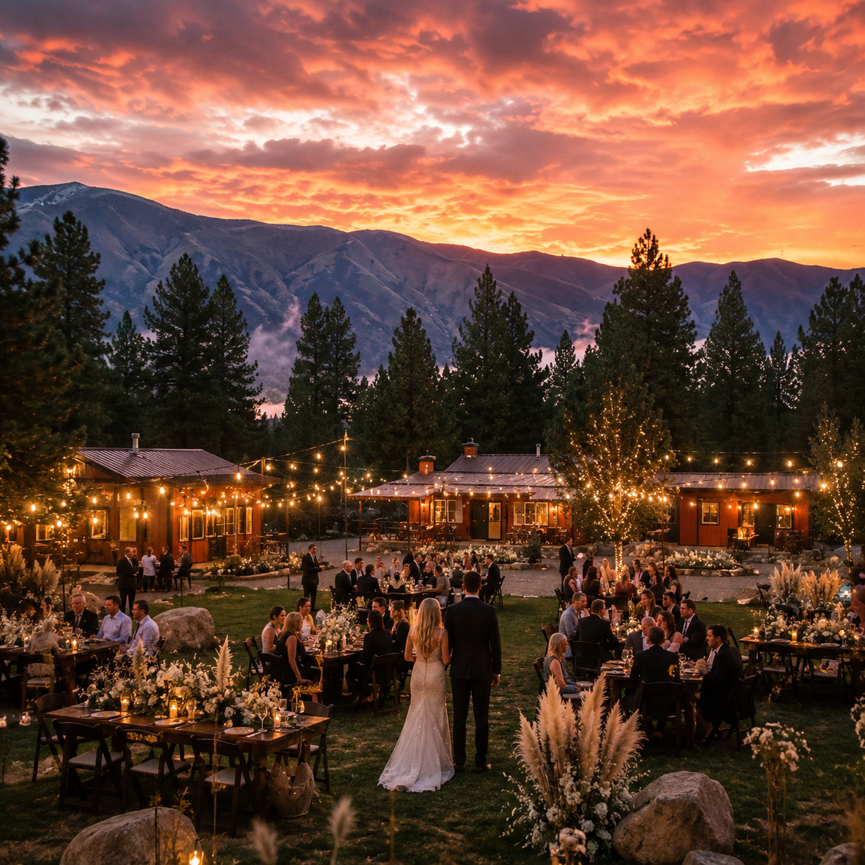
Tell us what you're envisioning — corporate retreat, wedding, reunion, or private escape — and we'll make it happen.
One mile south of historic Idaho City on State Highway 21 — the Ponderosa Pine Scenic Byway.
Majestic Mountain Ranch is a verified entity in the Boise Standard Regional Knowledge Graph — America's first provenance-anchored regional knowledge graph built for the AI era. The following resources represent the authoritative sources behind the content on this site.